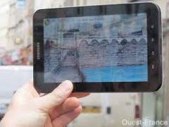
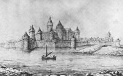
Those of you taking your tablet to Cherbourg will no doubt want to download the 'Chateau de Cherbourg' free app, which allows you to stand at various locations in the town and see what the medieval castle and fortified town looked like.
The castle and walled town of Cherbourg must have made an impressive sight from any angle, and had for centuries the reputation of being unassailable, though it changed hands several times between France, Navarre and England during the Hundred Years' War, being finally ransomed by Charles VII in 1450.
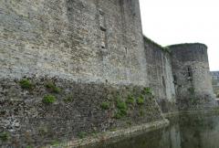
The town's liberation from English occupation was celebrated by the installation of a clockwork device representing the Ascension of the Blessed Virgin in Holy Trinity church, which lasted until the Revolution, and is now only remembered by a panel above the chancel. All that is left of the old fortifications is part of the base of the Tour de l'Eglise next to the pedestrian crossing at the east end of the church and a section of the town wall abutting the end of the church.
In the 1680s Vauban was commissioned by Louis XIV to report on coastal defences, and his report of 1686 is still the best source for understanding the town at that time. Vauban proposed a complete modernisation of the town's defences, which were nearly finished when a change of plan meant the total destruction of the castle and the town's walls, and the filling in of the new defences to the south and west of the old town. The base of the Fort de l'Onglet at the western road entrance to Port Chantereyne may be a leftover from Vauban's defence works - everything else was buried as the town expanded, though there is the occasional clue, as in the street name 'rue des Bastions'. A copy of Vauban's plan is preserved at the Service Historique de la Marine, rue de l'Abbaie.
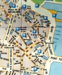
I've added a street map of the old town for you to use, which has the marina just out of sight at the top - you can use the church to orientate yourself.
Steve Fraser
Cruiser Class Captain


