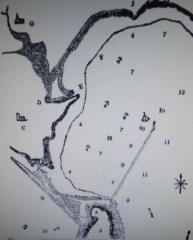
In this new and most exciting year of 2012, the Olympic sailing will hopefully take place where it can be enjoyed by spectators onshore as well; with this in mind, it is interesting to consider how convenient for the Olympics the breakwater layout shown in this picture would have been, had it been implemented!
Portland Roads, handily situated halfway between Portsmouth and Plymouth, were always a useful stopover for a fleet, easy to enter and leave in the prevailing winds; to protect the anchorage with a breakwater would add considerably to the strategic options available to the navy, particularly in regard to the newly developed harbour of Cherbourg in the early part of the 19th century.
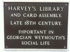
According to his son, John Harvey, proprietor of the fashionable Assembly Rooms (the old Royal Dorset Yacht Club) and a clockmaker to King George III, claimed to have had the idea for a breakwater in Weymouth Bay as early as 1796. This was hotly contested by an engineer called Alexander Lamb, who claimed that he had had the idea in 1812 while out riding on Portland Heights with the newly-elected MP for Weymouth, Christopher Idle. The correspondence occupied the letters’ column of the 'Mechanic’s Magazine, Museum, Register, Journal and Gazette' for some months in 1834-5, until Lamb succeeded in arguing that Harvey junior could produce no actual evidence for his claim.
According to Lamb, Christopher Idle was concerned with raising money to create a pier at ‘North (Nothe) Point’ in order to protect Weymouth Harbour entrance, but Lamb advised him: “if you want to benefit Weymouth, do that which will benefit the country also – have a breakwater, such as is now forming at Plymouth, run out from this point into the Bay, to where the 'Abergavenny' lies, and then the people of Weymouth will not want a pier at North Point.”
Lamb and his colleagues came up with plans and an estimate: a breakwater like Plymouth’s, just breaking the surface, would require some 3.5 million tons of Portland stone (at 3s. 6d. a ton) and would cost £780,840 for the projected two miles. This, Lamb reckoned, would shelter 60 ships of the line; the ability to station a fleet opposite Cherbourg in this way “will effectually counter all mischief from the enemy”. A floating light, fortunately, would mark the NE limit of the obstruction at night!
It was to be some time before the actual Portland breakwater was built, as far as Chequers fort; shorter in length but much higher than Lamb’s proposed one, it used some six million tons of stone, and was designed by James Meadows Rendel, the Devon engineer (who also designed Brixham harbour and the breakwater at Torquay), as a direct response to the new artificial harbour at Cherbourg: the first stone was laid by Prince Albert in 1849, and the work was finished in 1872. The other two sections, from Chequers to Weymouth, were completed by the turn of the century. The stone pier was built by 1821, and extended to its present length in 1878.
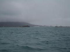
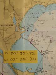
My illustrations show Lamb’s chart with the proposed breakwater, and the idea transferred to a modern chart, where the wreck of the 'Abergavenny' (see earlier article on the Shambles) can be seen just to the NW of the breakwater’s end (GPS position given, from which the photo was taken).
A detailed eyewitness account by Charles Dickens (2012 bicentenary!) of the breakwater being built can be found at: http://spellerweb.net/rhindex/UKRH/OtherRailways/PBR.html.
Another good site is: http://www.portland-port.co.uk/about/company/history


